The use of UAVs for civilian applications, while still is in the early stages, is slowly becoming more widespread, with restrictions and roadblocks being lightened or streamlined. UAVs are predicted to be an integral part of business and governmental activity, from unmanned cargo deliveries to precision agriculture and large area mapping, UAVs are ready to take-off!
Decreasing risks and costs, UAVs are incredibly beneficial to undertake tasks which are not physically feasible for humans to perform promptly, efficiently, cost-effectively and most important, safely.
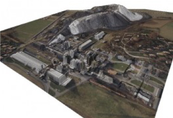
Comprehensive end-to-end solutions for a wide range of civil uses, our proprietary mapping payloads and supporting software packages, allow our systems to shift from video mode to a production tool for accurate/high-resolution orthophoto and large area mapping products.
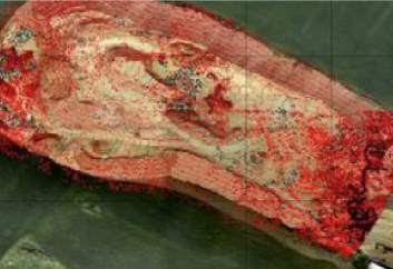
Users can quickly shift to high-resolution RGB or optional thermal and/or radiometric image-based collection and transform this data to different maps such as agricultural indices (NDVI and GRVI), geological, and mining maps and more, providing near-real-time tactical mapping on-demand (TMOD) capabilities.
CSS UAVs can be easily customized and adapted for a vast scale of civil uses, requiring minimum effort, time, and capital, allowing easy access to remote areas with minimal manpower. These applications include real-estate mapping and 3D, storm tracking and forecasting cyclones, unmanned cargo delivery, supplying essentials for disaster management, search and rescue operations, geographic mapping of inaccessible terrain and locations, different maps and products for Precision Agriculture - DSM (Dense Surface Model), 2.5D & 3D Mesh data basis, thermal radiometric (firefighting, utilities infrastructure monitoring, etc.) maps, agricultural indices (NDVI, GRVI, etc.), geological and mining maps, RGB or optional thermal images, and others.